
The Plenty Highway
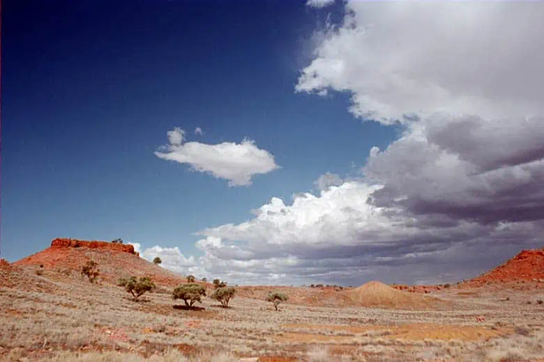
 The Plenty Highway is an outback road mostly unsealed between north-western Queensland and the Stuart Highway in the Northern Territory. From Boulia in Queensland to Alice Springs is a little over 900 kilometres. Some say it is a relatively featureless and rough track, but the Plenty Highway is quite good if you travel from Brisbane to Alice Springs, as it is the shortest route. Nevertheless, it is pretty slow going, and there is no doubt that it is an isolated part of the country. These are the roads we love as the isolation adds to the whole experience, and we enjoy being self-reliant.
Vehicles and Fuel
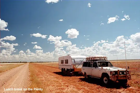
Vehicles you are considering taking across the Plenty Highway should be in tip-top condition, as any repairs in this neck of the woods will cost a veritable fortune… even if you are fortunate enough or could coax someone to come out and fix the problem! There are few facilities along this route, so you need to be self-contained and carry enough spares to get yourself out of trouble. Also, you will need to carefully work out your fuel consumption, particularly if you have a large juice guzzler. It always pays to carry spare fuel. At least 20-40 litres in addition to the estimated amount on each leg. Besides being embarrassing, running out of fuel is irresponsible and downright dangerous at worst.
East to West Overview
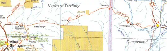
Travelling east, the road leaves the Stuart Highway 68kilometress north of Alice Springs, follows the Sandover Highway for the first 27kilometress and then heads to Tobermory Homestead on the Northern Territory/Queensland border. Although I have travelled the Plenty Highway twice with a dual axle van, NRMA and others suggest the road is NOT suitable for caravans. So please be aware.
The route continues to Boulia, in Queensland, changing from Plenty to Donohue Highway at the border. Our first trip across the Plenty Highway took place in 2001, and the return trip was in 2002. I imagine that people will read this in years to come, and the road will be pretty different, so our trip is a snapshot in time. The Great Central Highway or Central Road is well underway to become a black road.
 The first 100 kilometres from the Stuart Highway to Ongeva Creek are sealed. The remaining 178 km to Jervois Homestead is unsealed, as is the rest of the track to Boulia. Track condition is obtained from the Harts Range police station, 112 km from the Stuart Highway. East of Jervois Homestead, the road deteriorates to rocks and bulldust as you near Tobermory, 213 km from Jervois Homestead. The road north to Urandangi and thence to Mt. Isa bears left just before Tobermory.
Donohue Highway
As at other Northern Territory / Queensland border crossings, the Plenty Highway becomes pretty ordinary east of the border into Queensland. Travellers should be aware of deep potholes and bulldust. Road trains frequently use the Plenty Highway, so watch out for them. It is 242 km from Tobermory to Boulia, and good camping may be found at the Georgina River, at about the 125 km mark.
Fuel and food may be obtained at Gemtree, Atitjere community, Jervois Homestead, Tobymorey and Boulia. Again, travellers should be warned that the Donohue Highway is not considered suitable for ordinary caravans and that road trains up to 53 metres in length use both highways.
Useful Contact Numbers – The Plenty Highway
| Police | Alice Springs | (08)8951 8888 |
| Camooweal | (07)4748 2148 | |
| HartsRange | (08)8956 9772 | |
| MountIsa | (07)4744 1111 | |
| Road Conditions | NT | 1800246 199 |
| QLD | 1300130 595 | |
| Services | AtitjereCommunity Store | (08)8956 9773 |
| GemtreeCaravan Park | (08)8956 9855 | |
| JervoisStation | (08)8956 6307 | |
| TobermoreyHomestead | (07)4748 4996 | |
| tourist information | BouliaShire Council | (07)4746 3188 |
| CentralAustralian Tourism | 1800645 199 |